We influence the world around us constantly, in our daily and professional life. We do this directly, in direct contact with real objects, with the city’s infrastructure, communications or transport. And we delegate our «powers» by applying for services to state and municipal, commercial and public organizations. In any case, all these influences, albeit little by little, change the state of our environment. The sum of such impacts from the entire population of the city is able to correct the vector and dynamics of the development of socio-economic processes in society as a whole. And as a result, each person sees before his own eyes how things, prices, events change day after day. Moreover, transformations take place not in abstract statistics, but in relation to particular places in the city, and they leave quite tangible traces that can be read and used efficiently.
The scientific and technological toolkit created in the Urban Computing Laboratory, at any moment in time, allows you to take a snapshot of the state of any object or person on the scale of an entire city. Yes, such a snapshot shows the consequences of events that have already taken place and decisions made once. On the other hand, it can be viewed as a complete list of needs dictated by the very life of the main stakeholders – you and me.
We have found an interesting analogy with the atomic rector in the course of researching the issue of managing urban processes. This made it possible to take a fresh look at the processes in socio-economic systems and propose the concept of exoactive management. The model of such management describes the de facto emerging situation of decentralization of areas of responsibility for decision making. Expectations of comfort and safety of the environment in which it fulfills the needs of its life activity are fixed in society. In response to these expectations, the principles of balanced development of the urbanized area were formulated.

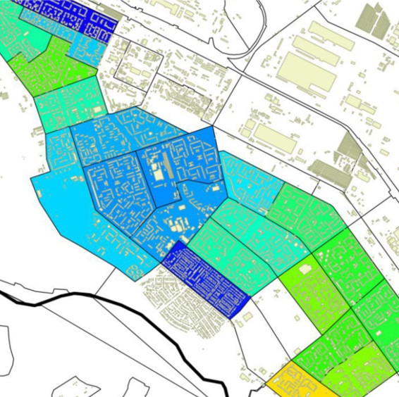
The UCLab laboratory has developed a methodology for decision support of urbanized areas development to improve urban management. We propose to comprehensively use the methods of intelligent data processing with the obligatory consideration of their spatial origin. The binding to the reference points of the space forms a level of knowledge integration that allows you to restore the logic of connections and the framework of the existing network of objects and interactions of stakeholders.
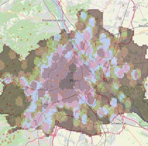
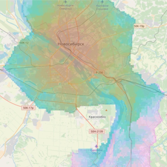
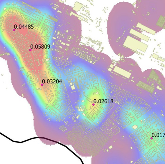
The corresponding methodological complex was developed to assess the coherence of the urban area and the efficiency of its use. The solutions created make it possible to analyze the consumer properties of the area, taking into account the real possibilities of existing urban infrastructure objects to ensure the required level of quality of life for residents.
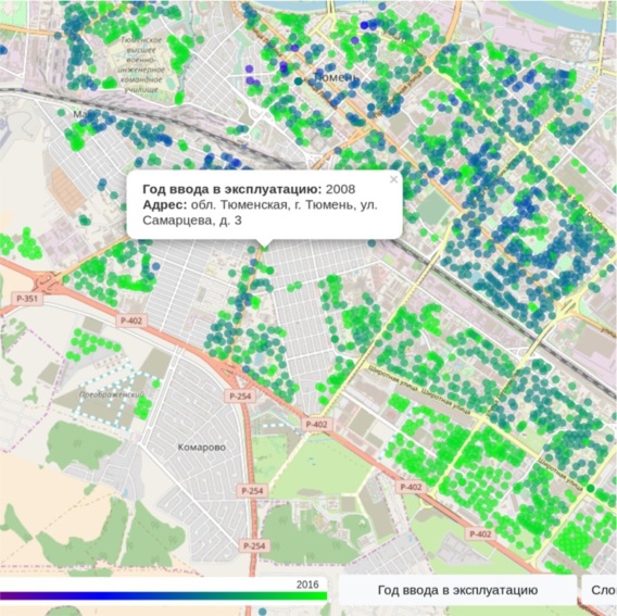
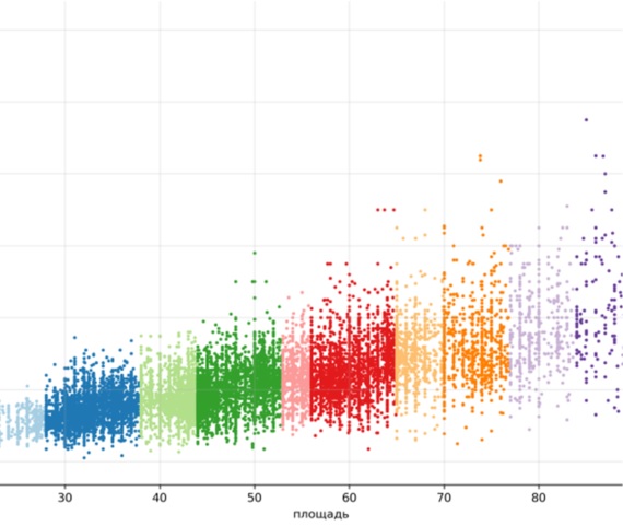
The developed methodological and algorithmic support allows the use of machine learning and carry out intelligent analysis of geospatial data. The implemented tools help to restore additional properties of the area objects. This, in turn, becomes the information basis for modeling the behavior of many agents, whose interactions produce a single developing model of the population’s life in the urban environment. And this is an effective tool for analyzing the purposes of using areas and the basis for decision support to meet the needs of stakeholders.
The theoretical developments of the UCLab scientific school formed the basis for the creation of applications and services, both for performing research tasks in the analysis of geospatial data and for end users. The UCLab department of advanced developments is working on combining the set of implemented software tools within the framework of a multi-service information and analytical online platform to support decision-making on the development of urbanized areas.

In the digital economy, everything is services that a person wants to receive efficiently, safely and conveniently. A “city life” service available on demand anywhere in the urbanized space is a management priority for sustainable development. The results of research and development obtained in the Urban Computing Laboratory are the basis for improving the theory of urban development management, taking into account modern trends associated with the reorientation of their functions.